After Jibhi · Kinnaur District
Jibhi to Sangla Valley
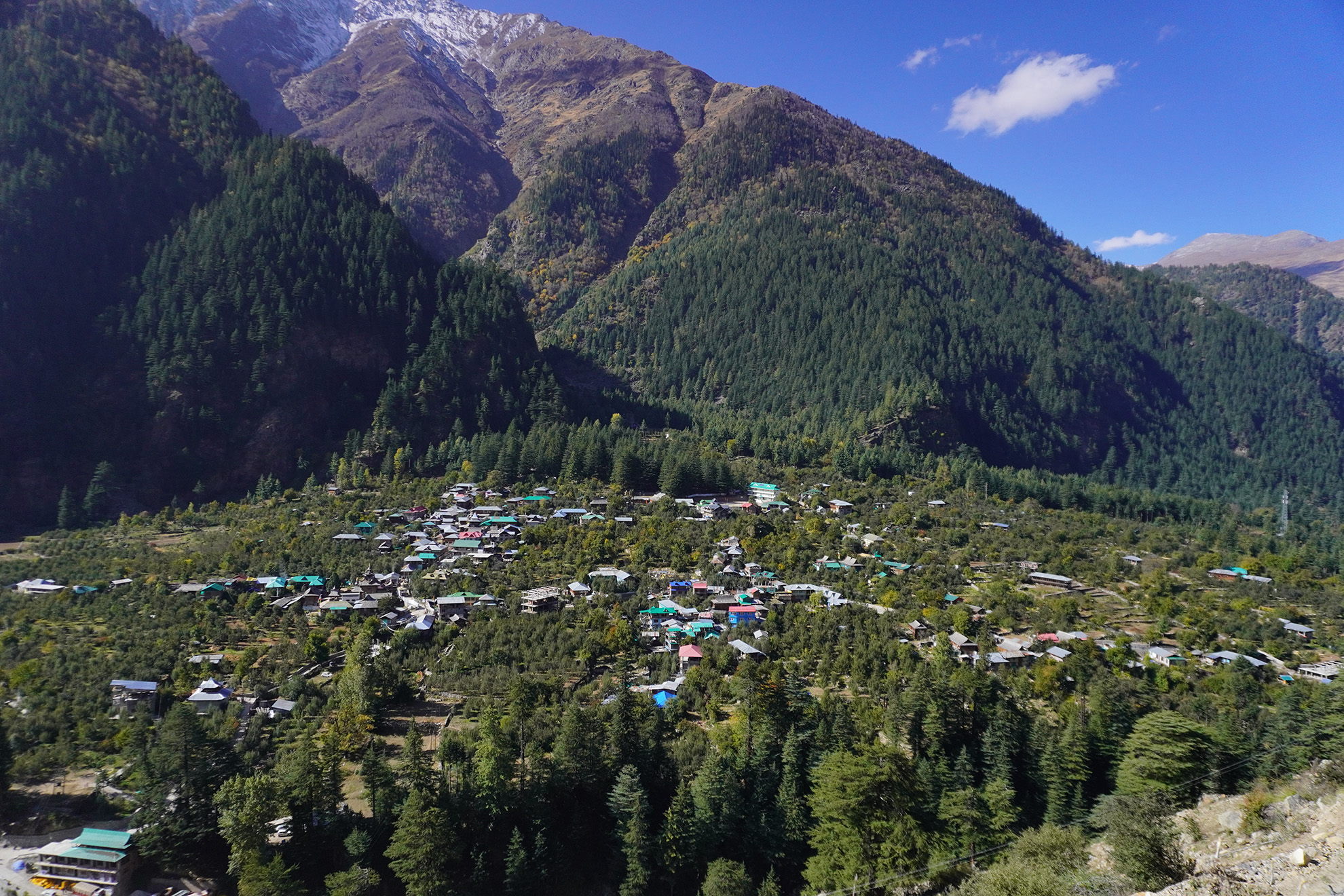
~191 km · 6–7 hours via Jalori Pass · Kinnaur, 2,600–3,450m
Kinnaur is the offbeat choice after Jibhi — and the route there is half the experience. From Jibhi you climb straight over Jalori Pass (3,120m), drop down through Anni into the Sutlej corridor, and follow it east into Kinnaur district. 191 km total to Sangla. The Sangla Valley runs along the Baspa River through apple and apricot orchards and Kinnauri Kath-Kuni villages, ending at Chitkul — the last inhabited settlement before the Indo-Tibet border at 3,450m. Allow two days minimum; three is better.
Quick Facts
Distance from Jibhi
~191 km via Jalori Pass
Drive time
6–7 hours
Altitude (Sangla)
2,600m
Altitude (Rakcham)
3,115m
Altitude (Chitkul)
3,450m
District
Kinnaur, Himachal Pradesh
River
Baspa River (Sutlej tributary)
Best season
May–Oct (road open)
Road closed
Nov–Apr due to snowfall
Nearest hospital
Reckong Peo District Hospital (~40 km from Sangla)
How to Get There
Route: Jibhi to Sangla & Chitkul via Jalori Pass
This route crosses Jalori Pass (3,120m) — one of the highest motorable passes in this part of Himachal. The road to the pass from Jibhi is narrow and partially unpaved near the top; suitable for most vehicles but not ideal in wet weather or after fresh snow. The pass is generally open April to November. Beyond Anni the road joins the Sutlej corridor toward Rampur, then follows NH5 east into Kinnaur. The Jeori to Sangla branch is steep and single-lane in sections.
Jibhi → Jalori Pass (3,120m)
13 km, ~45 min — steep climb from Jibhi on a narrow road; partially unpaved near the top; views of the Banjar Valley open up behind you
Jalori Pass → Anni
30 km, ~1 hour — descend via Shoja through the Kullu district hills into the Anni tehsil; the road improves significantly below Shoja
Anni → Rampur Bushahr
55 km, ~1.5 hours — head east toward the Sutlej River; join NH5 at Luhri and follow the Sutlej gorge northeast to Rampur
Rampur → Jeori
22 km, ~40 min — continue east on NH5 along the Sutlej; Jeori is the turn-off for Sangla Valley
Jeori → Sangla
71 km, ~2.5 hours — branch road climbs into the Baspa Valley; narrow and winding in sections; apple orchards appear along the lower stretch
Sangla → Chitkul (via Rakcham)
~28 km, ~1 hour — follow the Baspa River through Rakcham (3,115m) to Chitkul; the road ends at Chitkul
What to Do
Highlights of Sangla Valley & Kinnaur
Kamru Fort — 1,000-Year-Old Bushahr Capital
Above Sangla village stands Kamru Fort — a five-story structure built in Kath-Kuni style approximately 1,000 years ago, which served as the capital of the Bushahr dynasty before the seat moved to Rampur. At the top is a Kamakhya Devi idol — brought, according to local tradition, from Assam. The fort is still an active temple. Visitors must remove leather footwear and wear a Kinnauri cap and a handmade waistband (both available at the entrance) before entering. The fort is not a museum — it is a place of ongoing worship.
Bering Nag Temple & Fulaich Fair
Sangla's most important temple is dedicated to Bering Nag, the serpent deity of the valley. Each September at the end of the flower-blooming season, the Fulaich fair is held here — a flower festival where local residents wear garlands of fresh wildflowers and carry the temple deity in procession. The Sangla ki Holi spring festival (called Faguli locally) is also celebrated at this temple in March, with a distinct Kinnauri character quite different from the plains version of Holi.
Rakcham — The Ghost Village
Between Sangla and Chitkul, at 3,115m, Rakcham earns its local nickname in winter: most residents migrate to lower altitudes when snow arrives, leaving the village largely empty from November to April. In season, it is a small, quiet Kinnauri village with traditional multi-storey wooden homes, prayer flags, and almost no tourists. Worth stopping even for 20 minutes to see the vernacular architecture up close.
Chitkul — Mathi Devi Temple
The most important temple in Chitkul is the Mathi Devi Temple — over 500 years old, built of walnut wood and stone, with three distinct shrines representing a Hindu-Buddhist syncretism unique to the Kinnaur border region. Mathi Devi is the 'spiritual governor of seven divisions' in local tradition, and the temple is the focal point of an annual high-altitude pilgrimage crossing the Lamkhaga Pass (5,300m) into Uttarakhand. Non-Himachali pilgrims rarely make this route.
Kagyupa Buddhist Temple, Chitkul
A few metres from Mathi Devi, the Kagyupa Buddhist Temple contains a large Shakyamuni Buddha idol and carved panels depicting the Four Directional Kings — the protectors of the four cardinal directions in Tibetan Buddhist cosmology. The village's two temples — one Hindu-rooted, one Buddhist — sit within walking distance of each other, expressing the valley's layered religious history.
Kinnaur Kailash Views
The Kinnaur Kailash range (6,050m) dominates the eastern horizon. The 78 km Kinnaur Kailash parikrama is one of Himachal's most demanding high-altitude circuits — crossing several passes above 5,000m. Visible clearly from Sangla, Rakcham, and Chitkul, the peak is especially striking at first light when the rock changes colour from grey to amber. The Bhasmasur myth of the mountain — a demon's penance interrupted by Shiva — gives Kinnaur Kailash its position as one of the most sacred peaks in the western Himalaya.
Apple Harvest (Sep–Oct) and Kinnauri Food
Kinnaur apples (Royal Delicious, Red Delicious) are harvested September to October, and the orchards around Sangla and Rakcham are vivid during this period. You can buy directly from growers. The local food to eat: Chilta (buckwheat pancakes served with mountain honey or apricot chutney), Kinnauri Rajma (a small red bean dish slow-cooked with local spices), and thukpa at Sonu's Tibetan Café. The most photographed eatery in the valley is 'Hindustan Ka Akhri Dhaba' near Chitkul — a small dhaba at the end of the motorable road.
Seasons
Best Time to Visit Sangla & Chitkul
May–Jun
Snow clearing, spring
Road opens after winter. Snow still visible on higher slopes and Kinnaur Kailash. Orchards in blossom. Fulaich preparations begin in villages. Good time to go before summer crowds build.
Jul–Aug
Monsoon — relatively dry
Kinnaur is in the rain shadow of the main Himalayan range and gets far less rain than Kullu or Parvati Valley. Usually safe to visit, though occasional landslides on the Sutlej gorge road are possible. Landscapes lush and green.
Sep–Oct
Apple harvest — best season
Peak season for Kinnaur. Apple harvest in full swing. Fulaich fair at Bering Nag Temple in September. Clear skies, golden light on the peaks, Kinnaur Kailash crisp at dawn. October is particularly beautiful. Book accommodation in advance.
Nov–Apr
Road closed
Heavy snowfall closes the road to Sangla and Chitkul from November. Rakcham residents migrate lower. Rampur and lower Kinnaur remain accessible but the Sangla Valley road is shut. Sazo Festival is observed in Kinnauri villages in January — but the valley is mostly inaccessible to outside visitors.
FAQ
How far is Sangla Valley from Jibhi?
Sangla Valley is approximately 191 km from Jibhi by road via Jalori Pass and Anni. The drive takes 6–7 hours: Jibhi to Jalori Pass (13 km), Jalori Pass to Anni (30 km), Anni to Rampur (55 km), Rampur to Jeori (22 km), then Jeori to Sangla (71 km) on the Baspa Valley road.
What is the altitude of Sangla, Rakcham, and Chitkul?
Sangla sits at 2,600m. Rakcham, between Sangla and Chitkul, is at 3,115m. Chitkul is at 3,450m. The altitude gain from Sangla to Chitkul is significant enough that altitude sickness is a real possibility for people who drive directly from low altitudes. The recommended acclimatisation sequence coming from Shimla is: Narkanda (2,700m) → Sangla (2,600m) → Chitkul (3,450m).
What is the protocol for visiting Kamru Fort?
You must remove all leather footwear before entering. A Kinnauri cap (topi) and a handmade waistband are required — both are provided at the fort entrance, sometimes for a small fee. The temple inside is an active place of worship, not a heritage museum. Photography inside the inner sanctum requires permission from the priest.
Do I need a permit to visit Chitkul?
No inner line permit is required for Chitkul or the Sangla Valley. The inner line permit requirement starts further east, toward Spiti via the Kinnaur circuit (Nako, Tabo, Kaza). Most travellers visiting Sangla and Chitkul do not need any special permit.
Are there HRTC buses to Sangla and Chitkul?
Yes. HRTC operates buses on this route: Shimla to Sangla departs at 6:50 AM (fare ₹550). Reckong Peo to Chitkul departs at 9:30 AM (fare ₹120). Chitkul back to Sangla departs at 1:30 PM (fare ₹50). These are approximate timings — confirm with the local HRTC depot as schedules change seasonally.
Is Kinnaur suitable for first-time Himachal travellers?
Yes. Sangla and Chitkul are accessible and do not require the same altitude acclimatisation that Spiti demands. Chitkul at 3,450m can feel cold and thin to some people — drink water, take it easy the first day. The Sutlej gorge drive is long and dramatic but well-travelled.
What etiquette should I observe in Kinnaur?
Do not bring leather items into temples (some temples specifically prohibit leather belts, shoes, and bags). Avoid drinking alcohol publicly. Do not point your feet at a temple, elder, or deity. At Kamru Fort, wear the Kinnauri cap and waistband provided at entry. Ask before photographing people — especially during festivals or inside temple courtyards.
Continue the Circuit
Start Here
Begin at Winterfell, Jibhi
Private wooden cottages in the Banjar Valley — a quiet first stop before the Sutlej gorge road east to Kinnaur.